The Canoe Is the People
Indigenous Navigation in the Pacific


Satawal Ways
Complex Taumako Swell Pattern
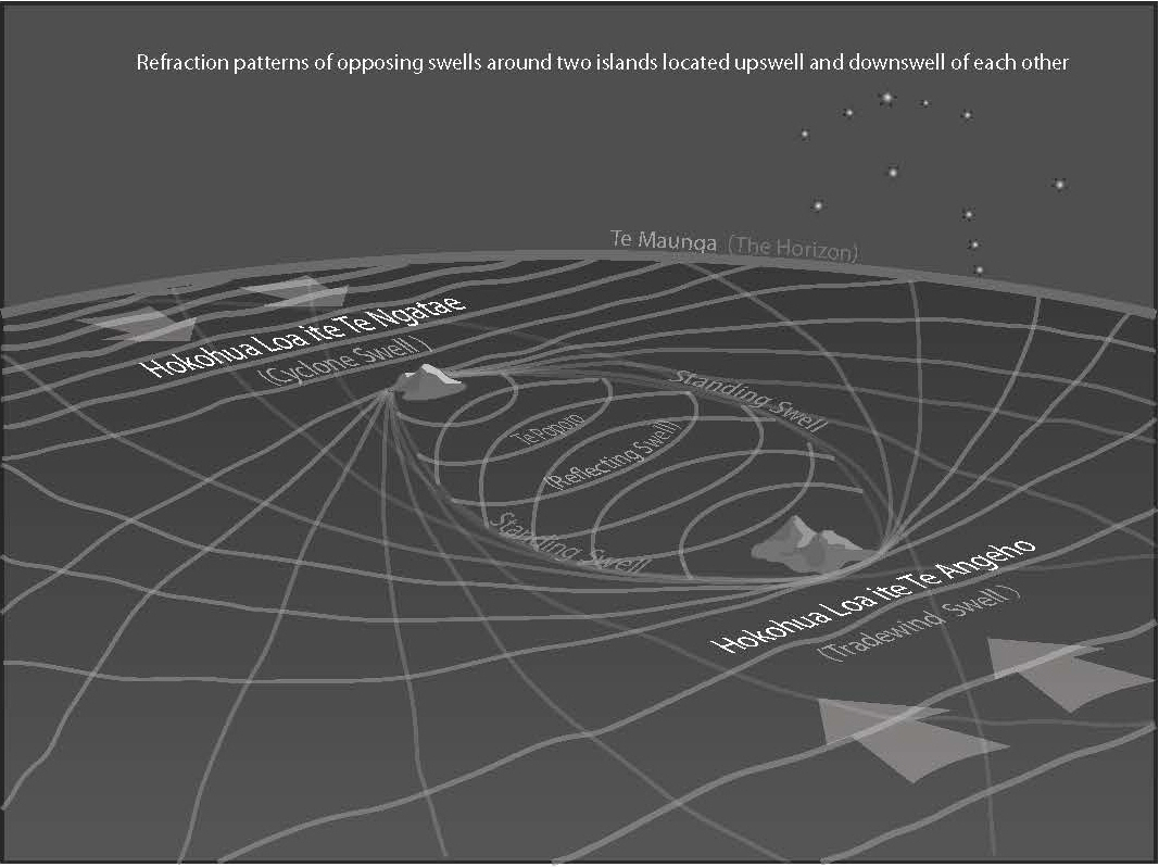
Chief Kaveia showed his students a combination of swell patterns that exists between Taumako and Nifiloli Islands. On the photo below, he draws in the sand and explains to a young man that there is an oval shape between Taumako and Nifiloli Island, and that oval shape is caused by parts of the two opposing swells that wrap around Taumako and Nifiloli Island from opposite directions. There are also part of those opposite swells that are bouncing back from each of these islands
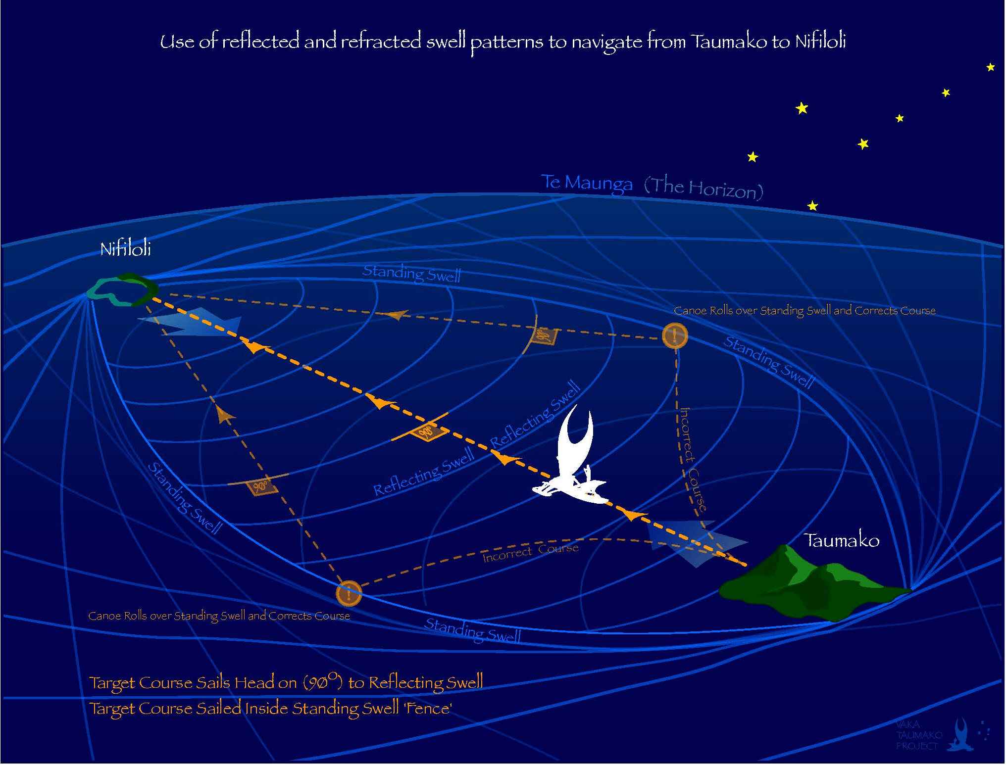
These two islands are about 75 miles apart from each other. When you are sailing between the 2 islands you can feel the reflected swells almost the whole way. They are short and steep and they make you jerk forward when they hit your Vaka. These reflected swells are like a homing beacon. If you sail at 90 degrees to the reflected swell you will be heading directly toward the island.
There are two big swells that come from opposite directions. One comes from the direction of Taumako and the other from the direction of Nifiloli islands. So one of them bends around Taumako and the other one bends around Nifiloli. Part of these opposing swells meet in between the two islands and they form a big oval shape that is a doubled up swell that you can experience right there in the sea. If you sail over this ‘standing swell’ your Vaka will make a big roll, and you will know if you have passed outside of the safe area for sailing between the two islands. Inside this area it is easy to feel the reflected swells and use them as a homing signal that shows you the way to the island.
Below is a diagram that shows all the lines that Chief Kaveia drew in the sand. There are two major swells coming from opposite directions. One comes from the East and one comes from the West.
When the wayfinder feels the short, steep, bounce-back swells (poroporo) then the Vaka must go ninety degrees (perpendicular) to the swells to find the island. These poroporo swells are like a homing signal that guides the wayfinder toward the island.
The big oval shape acts like a wayfinding fence around the safe area between the two islands. A student wayfinder must learn to feel if the vaka goes over the fence, or not. If the vaka goes outside this oval shape it may go past the island without feeling the poroporo little swells boucing back off the islands. So the wayfinder will not realize that the vaka is going past the island. Then it will be hard, or impossible, for the vaka to get back into the safe area and arrive at the destination island.
Here a Vaka is sailing between islands within the swell “fence” formed by the merging of two opposite swells, and with reflected “bounce-back” swells coming from both islands.
It takes a lot of practice at sea for students to learn to recognise the feel and appearance of complex swell patterns, especially if there are rough conditions, like storm waves (caused by locally strong winds), criss-crossing over the swells, and if the currents and winds are creating confusion in the patterns.
Like ofanuw, arurwow is a way of remembering the star paths between islands. The navigator imagines an ura (parrot fish) hiding in the wow (reef channel) of an island. When the fisherman tries to catch the ura, it swims to the wow of the next island. Again the fisherman tries to catch the ura, and again it swims to the next island. Finally, it returns to the wow in Satawal. Because navigators never say the island names in arurwow, they can use it to talk about voyages in secret (the same as in sea brothers).
Kaveia drawing oval in sand between islands